Сколіўскія Бяскіды
.mw-parser-output .t-geoinfobox td,.mw-parser-output .t-geoinfobox th{min-width:120px}.mw-parser-output .t-geoinfobox td:only-child,.mw-parser-output .t-geoinfobox th:only-child{text-align:center}.mw-parser-output .t-geoinfobox-name{font-size:110%;padding:2px}.mw-parser-output .t-geoinfobox-nickname{font-style:italic}.mw-parser-output .t-geoinfobox-cave th:only-child,.mw-parser-output .t-geoinfobox-mount th:only-child{background:#e7dcc3}.mw-parser-output .t-geoinfobox-surface th:only-child{background:#ffe4c4}.mw-parser-output .t-geoinfobox-blue th:only-child,.mw-parser-output .t-geoinfobox-water th:only-child{background:#c0daff}.mw-parser-output .t-geoinfobox-underwater th:only-child{background:#b0e0e6}.mw-parser-output .t-geoinfobox-green th:only-child{background:#d0f0c0}.mw-parser-output .t-geoinfobox-tomb th:only-child{background:#bbbbbb}.mw-parser-output .t-geoinfobox-yellow th:only-child{background:#fdeaa8}.mw-parser-output .t-geoinfobox-ny th:only-child{background:#cbd5c4;border:1px solid #aaaaaa}.mw-parser-output .t-geoinfobox-ny th:first-child:not(:only-child){background:#cbd5c4;text-align:right;padding:0 0.5em}.mw-parser-output .t-geoinfobox-grey th:only-child{background:#eaecf0}
Сколіўскія Бяскіды (укр.: Сколівські Бескиди) — частка горнага масіву Усходніх Бяскідаў на терыторыі Львоўскай, часткова Івана-Франкоўскай абласцей. Назву масіў атрымаў ад размешчанага побач горада Сколэ. Найвышэйшы пункт масіву — гара Парашка (1268,5 м).
Будова
Масіў Сколіўскіх Бяскідаў складзены ў асноўным з флішу. У рэльефе пераважаюць паралельныя асіметрычныя хрыбты з вяршынямі Парашка, Высокі Верх, Магура, Трасцян і г. д.
Прырода
У лясным покрыве дамінуюць ялова-піхтавыя лясы, пашыраюцца плошчы другасных лугоў, на верхнім ярусе гор захаваліся фрагменты карэнных субальпійскіх лугоў. Рачныя даліны тэрасаваныя, даліны большай часткай разараныя.
На тэрыторыі Сколіўскіх Бяскідаў у 1999 годзе створаны Нацыянальны прыродны парк «Сколіўскія Бяскіды».
Сколіўскія Бяскіды з’яўляюцца раёнам пешаходнага, воднага і лыжнага турызму.
Галерэя
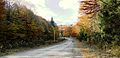 Сколіўскія Бяскіды. Горная дарога.
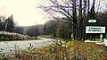 Ландшафты Сколіўскіх Бяскідаў.
 Сколіўскія Бяскіды. Выгляд на Тухольку.


Літаратура
- Географічна енциклопедія України: в 3-х томах / Ред. О. М. Маринич. — К. : «Українська Радянська Енциклопедія» імя М. П. Бажана, 1989 — ISBN 5-88500-015-8
Спасылкі
 На Вікісховішчы ёсць медыяфайлы па тэме Сколіўскія Бяскіды
Катэгорыя·Горныя хрыбты паводле алфавіта
Катэгорыя·Вікіпедыя·Артыкулы з пераазначэннем значэння з Вікідадзеных
Катэгорыя·Горныя хрыбты Усходніх Карпат
Катэгорыя·Горныя хрыбты без геаграфічных каардынат
Катэгорыя·Геаграфія Львоўскай вобласці
Катэгорыя·Горныя хрыбты Украіны